Australians will be keeping the beanies and woolies on this week as a very cold air mass parks itself across much of the country this week,
For many parts of southeastern Australia maximum and minimum temperatures over coming days are going to be well below average.
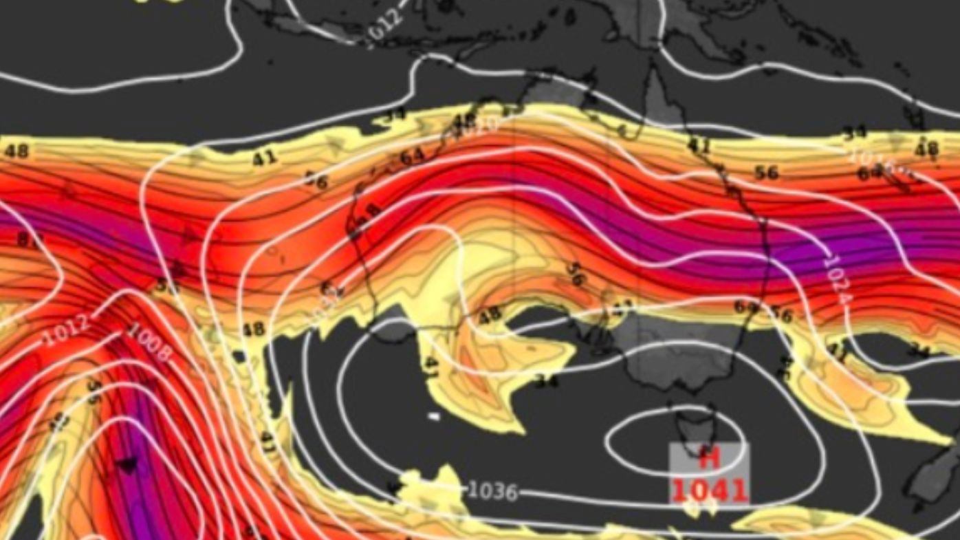
The cause is high pressure crossing the Great Australian Bight in the wake of a cold front that swept over south-eastern regions on the weekend.
READ MORE: Two men fighting for life as highway reopens after horror Queensland bus crash
While high pressure is common after a cold front, this particular system will stall from early tomorrow and become what meteorologists term as a “blocking high”.
It will trigger an extended run of sunny days, but cold frosty nights for most of Tasmania, and large parts of Victoria and southern New South Wales.
Launceston is forecast to fall below zero degrees for the next seven consecutive mornings.
In Queensland and northern NSW, the high pressure is bringing persistent south-easterly winds to the coast, increasing the chance of showers each day, as well as established ocean swell.
For the remainder of northern Australia, the high to the south will increase winds, leading to warmer days. The increased winds also increase their fire danger at the start of the northern Australia bushfire season.
For parts of South Australia and Western Australia, the high means the low-pressure systems and cold fronts this week are more likely to bring rain for longer periods than normal.
links to content on ABC
9News