The east coast of Australia is bracing for a blast of wet and windy weather from today, with temperatures almost halving in some parts.
The spring cold snap took hold early this morning in New South Wales as cold southerly winds and rain spread up the coast.
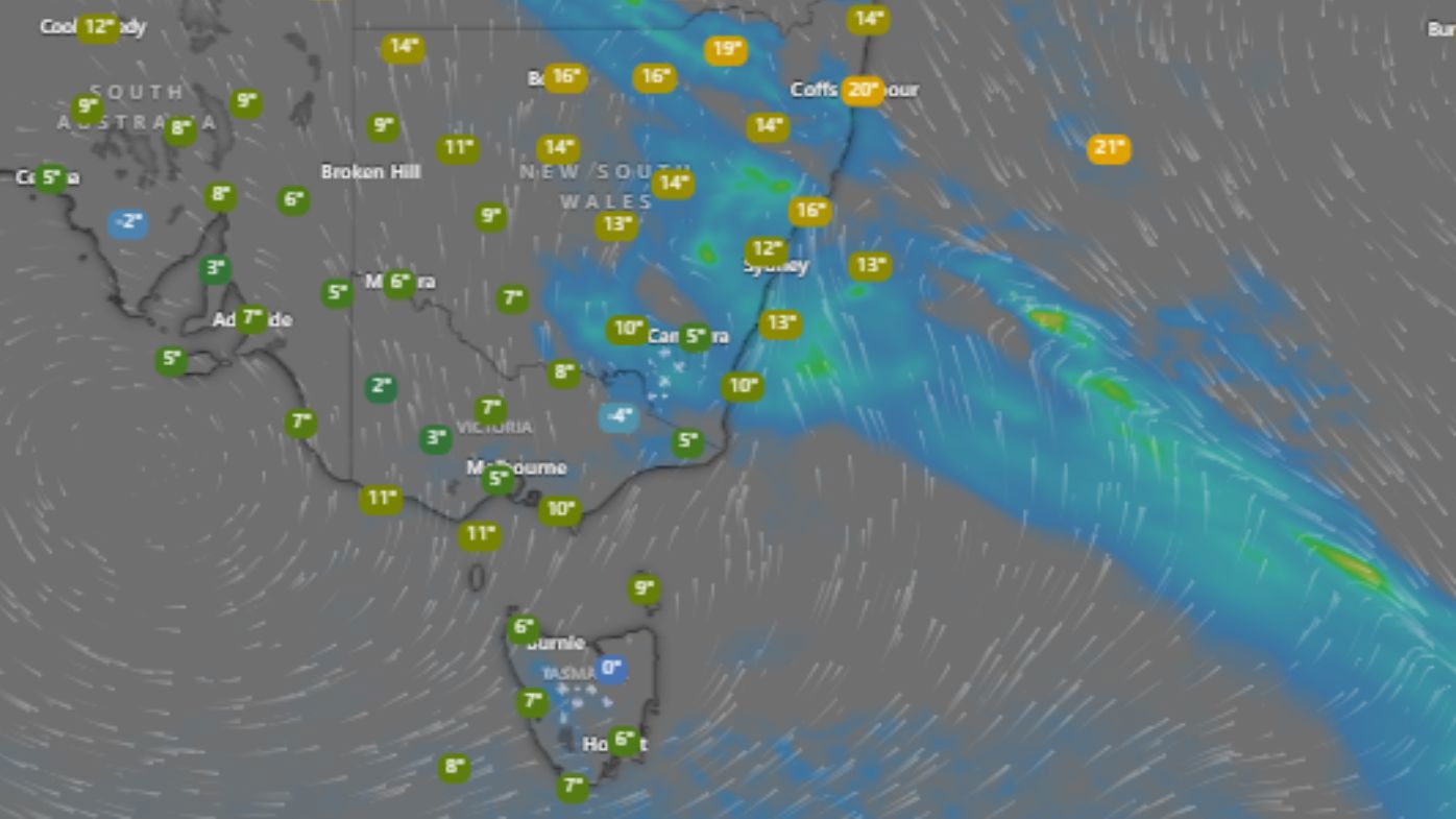
Sydney can expect a drenching over the coming hours, with falls of up to 40mm forecast, while other parts of the state are forecast to receive 60mm or more, the Bureau of Meteorology says.
READ MORE: Israeli army chief says military preparing for possible ground operation in Lebanon
The wet conditions will be accompanied by temperatures in Sydney falling from a high of 30 yesterday to today’s maximum of just 15 degrees.
But high winds will make the “feel like” temperature feel much cooler at a maximum of only 10 degrees in many parts of the city.
A gust of 70km/h was recorded at Sydney airport early this morning, making the apparent temperature in the city’s southern suburbs feel like a very chilly 3 degrees.
It was little better in other parts, with the mercury hovering in the city centre and western suburbs at about 8 degrees.
The bureau has also issued a hazardous surf warning for the Sydney and Hunter coasts, with gale-force winds expected.
The NSW State Emergency Service has begun preparing for possible flooding ahead of the volatile weather.
Residents are urged to prepare their homes for heavy rain and wind by cleaning gutters, tying down loose objects such as trampolines, and parking cars away from trees.
They are also being reminded to avoid driving, riding or playing near flood waters.
FOLLOW US ON WHATSAPP HERE: Stay across all the latest in breaking news, celebrity and sport via our WhatsApp channel. No comments, no algorithm and nobody can see your private details.
links to content on ABC
9News