A state of emergency was declared for the New Zealand city of Dunedin as it has its wettest day in more than 100 years.
“I didn’t expect the event to be of this magnitude,” city mayor Jules Radich said on Friday morning.
According to NIWA, Dunedin’s Musselburgh station recorded its second-wettest day on record with almost 131mm in the 24 hours to 9am today local time (6am AEST). The last time it was at least this wet in Musselburgh was in April 1923.
READ MORE: Dad slugged with $25k defamation bill over Facebook post he didn’t write
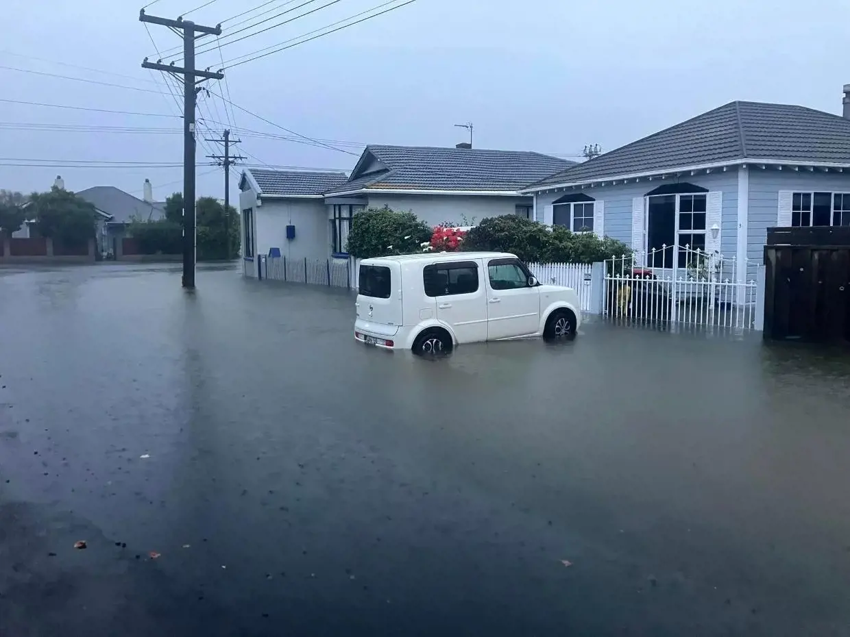
Residents in low-lying parts of Dunedin, including in South Dunedin, were worst hit by “significant surface flooding” overnight.
A whopping 143mm of rain fell in Dunedin between 4pm on Wednesday to 8am Friday – more than twice the normal rainfall for October of 60mm.
Residents were urged to keep off the roads due to potential slips and surface flooding as another 40mm to 60mm of rain was expected to fall in Dunedin up until 11pm Friday.
READ MORE: ‘Sitting and waiting to die’: Australian teacher stranded in Lebanon
MetService warned the heavy rain could cause threat to life from dangerous river conditions and significant flooding and slips.
“Conditions will disrupt travel, make some roads impassable, and isolate communities,” it said.
A major slip cut across Burkes Drive in the suburb of Maia and roughly 30 roads were closed around Dunedin due to flooding and slips. Evacuation centres had been set up at the Forsyth Barr Stadium and the St Clair Golf Club.
READ MORE: Heat bears down on millions for long weekend
Radich said the city’s pumps and pipes were coping well with the water.
He said he was extremely proud of Dunedin residents, who had come together to help each other.
“It made me very proud to see,” he said.
Controller Chris Henderson said there had been land movement on both sides of Otago Harbour, which had impacted the water supply and blocked roads.
READ MORE: Newborn twins who died alongside their mother are Helene’s youngest victims
He asked people to conserve water.
“We have contractors and staff heading out to urgently fix a break in the water supply pipe and clear the slip.”
Emergency Management Minister Mitchell said the response had been “outstanding” by authorities and emergency services.
Fire and Emergency NZ (Fenz) said firefighters attended 34 callouts overnight. Homes were evacuated near a landslide in the suburb of St Leonards. People were evacuated, but no injuries were reported.
An Urban Search and Rescue (USAR) team has been mobilised from Christchurch to provide support, including a specialist drone team and a geotechnical engineer.
The Dunedin City Council said about 70 people had evacuated and there was flooding across the city including Peninsula Rd and around the Hoopers and Papanui Inlets, Green Island, Caversham, and Musselburgh.
The Council repeatedly encouraged residents in South Dunedin, particularly in and around Caversham, to evacuate to higher ground if they noticed rising flood waters or did no feel safe in their homes.
The rare red heavy rain warning issued for north Otago, Dunedin and coastal Clutha will remain in place until 11pm Friday.
Around midnight Thursday, resident Chris Reynolds says garages on Surrey St were flooded with around 30cm of water.
“I expect if [the rain] continues some houses will be next as household pumps are no longer pumping water away from the properties,” he said.
There are a number of roads closed in South Dunedin, including Bay View Rd, between Forbury Rd and Prince Albert Rd, Loyalty St, Josephine St, Nelson St, Edwin St, between Alfred St and Hillside Rd and Surrey St, between Ruskin Tce and Hillside Rd.
NZ Transport Agency Waka Kotahi has closed State highway 90, north of Gore, between Waikoikoi and Tapanui after the Pomahaka River burst its banks late Thursday night.
Southland remains under a heavy rain watch until 4pm Friday.
A landslide is thought to have ruptured a water main on the peninsula, leaving households from Irvine Road out to Macandrew Bay and Portobello without water.
A long stretch of Portobello Rd has been closed along the waterfront from Doon St to Castlewood Road.
On the other side of the inlet, a landslide has covered part of Aramoana Road between Careys Bay and Deborah Bay, and a blocked culvert is causing significant flooding across the road on the same road in Careys Bay.
More than 146mm of rain had fallen at the Otago Regional Council’s monitoring station at Sullivans Dam in the 48 hours to 9am Friday, almost exceeding Metservice’s total expected rainfall with more than 12 hours of the red rain warning remaining.
Emergency Management Otago says people should be particularly wary of rising waters of the Silverstream at Gordon Road, on the edge of Mosgiel township; Balclutha, and the Pomahaka and coastal communities around the Tokomairiro area.
The Leith river hit the first flood warning level at 10pm on Thursday however the level has consistently fallen away since then. A second peak for the Silverstream, Leith and Lindsay are expected on Friday afternoon.
This article originally appeared on Stuff and is republished here with permission.
links to content on ABC
9News