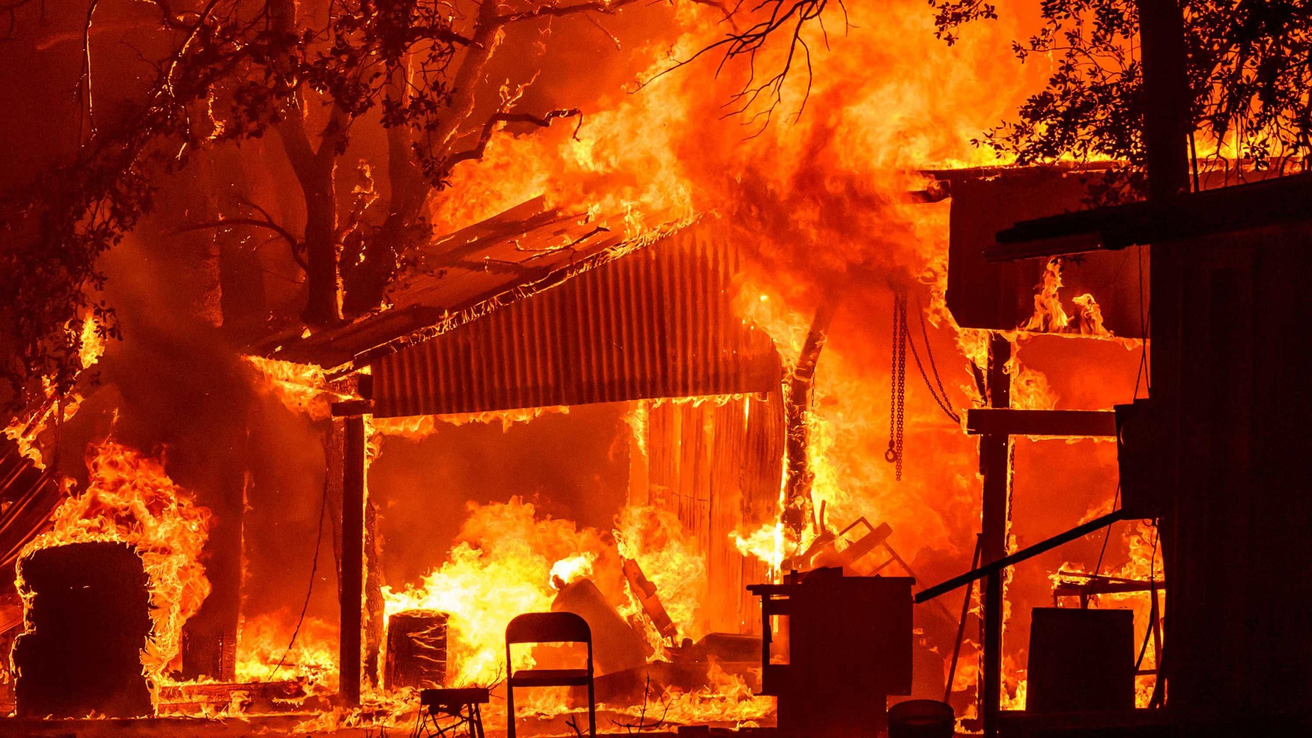
Large, explosive and destructive fires have torn through parts of California this year, well before the state’s most extreme fire weather conditions typically arrive, and it’s stoking fears that the season has devastating potential to come.
It’s all happening because weather extremes that are becoming more likely in a warming world are combining with volatile effect.
It’s been a typical fire season in California so far based on overall statistics.
READ MORE: Aussies on low incomes priced out of rentals across most of the country
More than 6000 wildfires have scorched nearly 1 million acres – very close to the average of about 950,000 acres, according to data from CAL FIRE.
Only, some of the fires have been anything but normal.
The Park Fire ignited in July in Northern California and grew so fast and furious it became the fourth-largest in state history.
The blaze tore through an area about the size of San Diego, destroyed at least 700 structures and injured at least three firefighters.
The still-burning Line Fire got so violent last week it created its own weather.
Just west of it was the Bridge Fire, which displayed jaw-dropping growth when it burned through about 19km of land in a single day, according to Tim Chavez, a retired assistant fire chief with CAL FIRE.
These fires all happened without the notorious seasonal winds responsible for fanning some of the most menacing flames in state history, according to Chavez.
The hot, dry air of the Santa Ana and Diablo winds originates in the desert and blows over mountains and out to sea.
These winds create easily ignitable, bone-dry fuels and blow so intensely they can morph a small flame into a massive blaze.
To have a fire like the Bridge Fire grow so rapidly without Santa Ana winds is “fairly significant and unusual,” Chavez remarked.
Instead, it’s what’s on the ground that’s been fueling them.
The amount of plant growth this year in parts of the state is nearly double what’s typical, mainly due to the state’s past two wet winters, according to Daniel Swain, a climate scientist at the University of California, Los Angeles.
All this new growth was dried out by bursts of heat during a record-hot summer. In early June, abnormally dry conditions only existed in about 1 per cent of California, according to the US Drought Monitor.
Now, more than 70 per cent of the state is abnormally dry or worse.
This wet to hot-dry pattern is becoming more likely because of climate change, Swain said.
The atmosphere is able to soak up more moisture as the world warms, like an increasingly larger sponge.
The sponge can wring out the moisture to unload torrential rain in the wet season, but it can also suck more moisture out of the ground during the dry season, meaning soil will get drier, Swain explained.
This sequence of sizzling summers following wet winters is one of the most potent combinations in repeatedly producing an active wildfire season because fire fuels regrow only to be dried and burned again, according to Swain.
Picture a desert environment where plant life is normally limited in scope.
“In a dry year, it’s very hard to get a wildfire to move through that landscape because (it) has natural fire breaks every five to 10 feet,” Swain explained.
“So lightning strikes a Joshua Tree, burns that tree, maybe an adjacent bush and that’s it.”
But that changes after a wet winter.
“You might have abundant growth of brush, and in particular invasive grasses that might fill in the gaps, literally increasing (the amount) of potential fuel,” Swain said.
Now any fire that starts after a hot, dry summer can spread farther.
Where peak fire danger could still be to come
Autumn marks a critical inflection point for fire season in California given typical weather conditions.
Santa Ana and Diablo winds typically start to pick up in September and bouts of them persist through May.
Once they arrive, the calculus for fire crews changes as fires driven by them make sudden, violent shifts.
Chavez is “always” concerned about what Santa Ana winds could unleash on the fire season in Southern California.
The region has already been highlighted by the National Interagency Fire Centre as a potential hotspot for fire activity through at least December.
But Chavez noted the state’s Central Coast could also be a trouble spot due to its immense fuels that have yet to burn.
Even if the Santa Ana winds hold off a little longer, it’s possible fire weather conditions similar to what facilitated Southern California’s recent blazes could reemerge as soon as the end of September, according to Swain.
Swain is eyeing a potential heat wave for late September into early October that could send temperatures soaring in California and the Southwest and dry out more fire fuels.
He is also concerned the state’s rainy season may have a delayed start.
Rain later in the season typically helps tamp down fire activity.
The number of extreme fall fire-weather days in California has more than doubled since the early 1980s because of warmer and drier autumns as global temperatures rise because of climate change, a study Swain co-authored found.
“Whether the winds or the rains win out is sort of that race that we play every year,” Swain said.
“I would say this year, more likely than not, the winds will win out in Southern California.”
links to content on ABC
9News


